Huge Topographic Lunar Maps; 1964
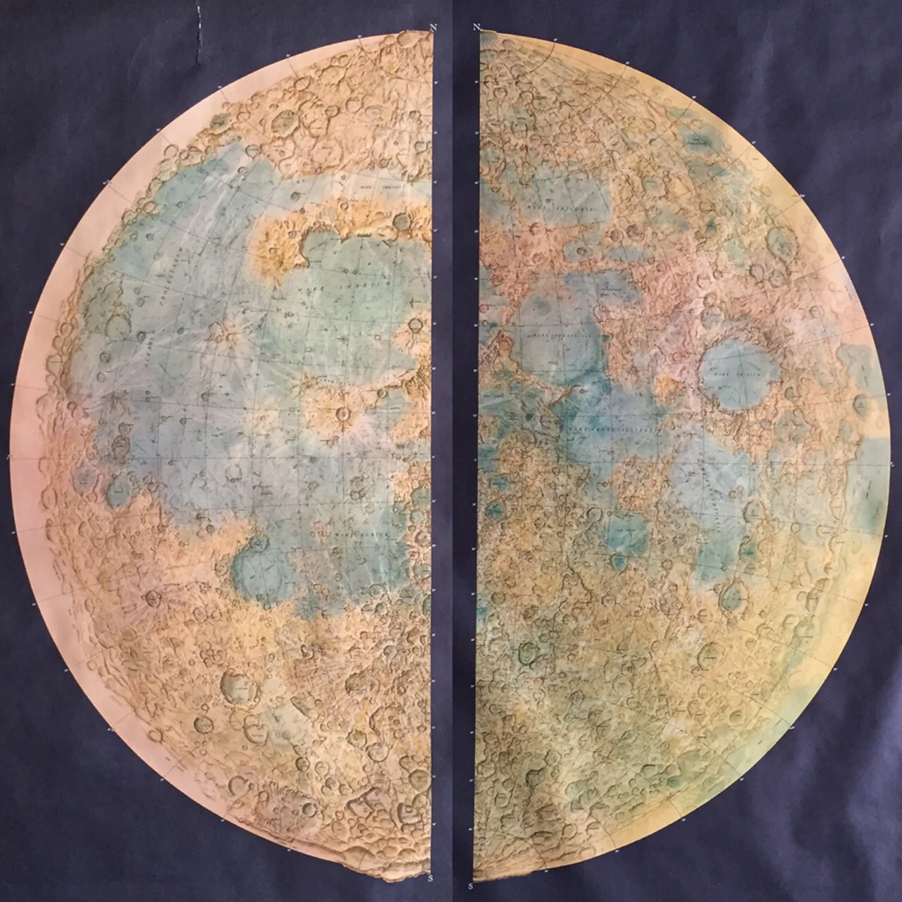


Huge Topographic Lunar Maps; 1964
*** The appraisal just came back in from the experts in London and he has valued the maps at $650-800 in their current condition. ***
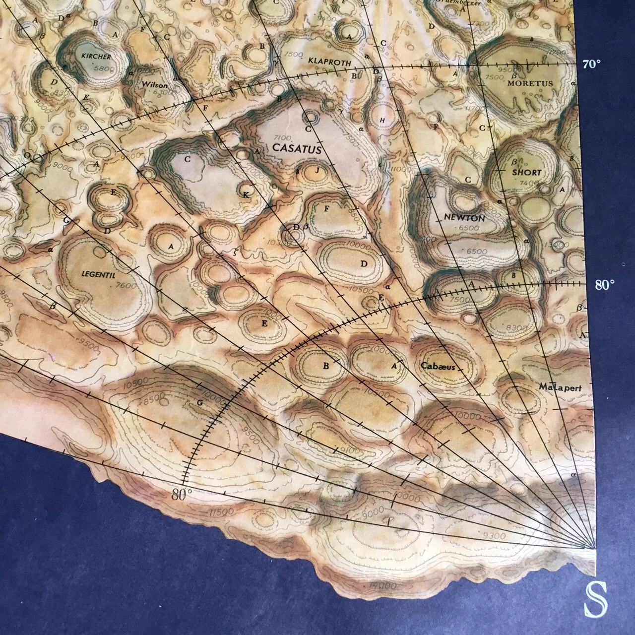
These might be the best maps I've had the pleasure to find! This set of 2 Topographic Lunar Maps from the Army Map Service, Corps of Engineers were printed in 1964. They show great detail in the landscape and were developed in anticipation of lunar landings at the end of the 1960's. A technique was developed a few years before that used multiple cameras in multiple locations on earth to photograph the moon and determine relative changes in height. These maps were critical in plotting potential landing locations for the Apollo missions.
I had to repair a long tear at the top of Map 2 (shown in the pics) but overall they are in pretty good shape with minor wear and tear around the edges. The corners do not have any pin holes.
These maps are incredibly scarce and equally beuatiful.
Each map measures 42" x 57"