Stunning 1891 Petite 3" Terrestrial Globe on Bronzed Base

Stunning 1891 Petite 3" Terrestrial Globe on Bronzed Base
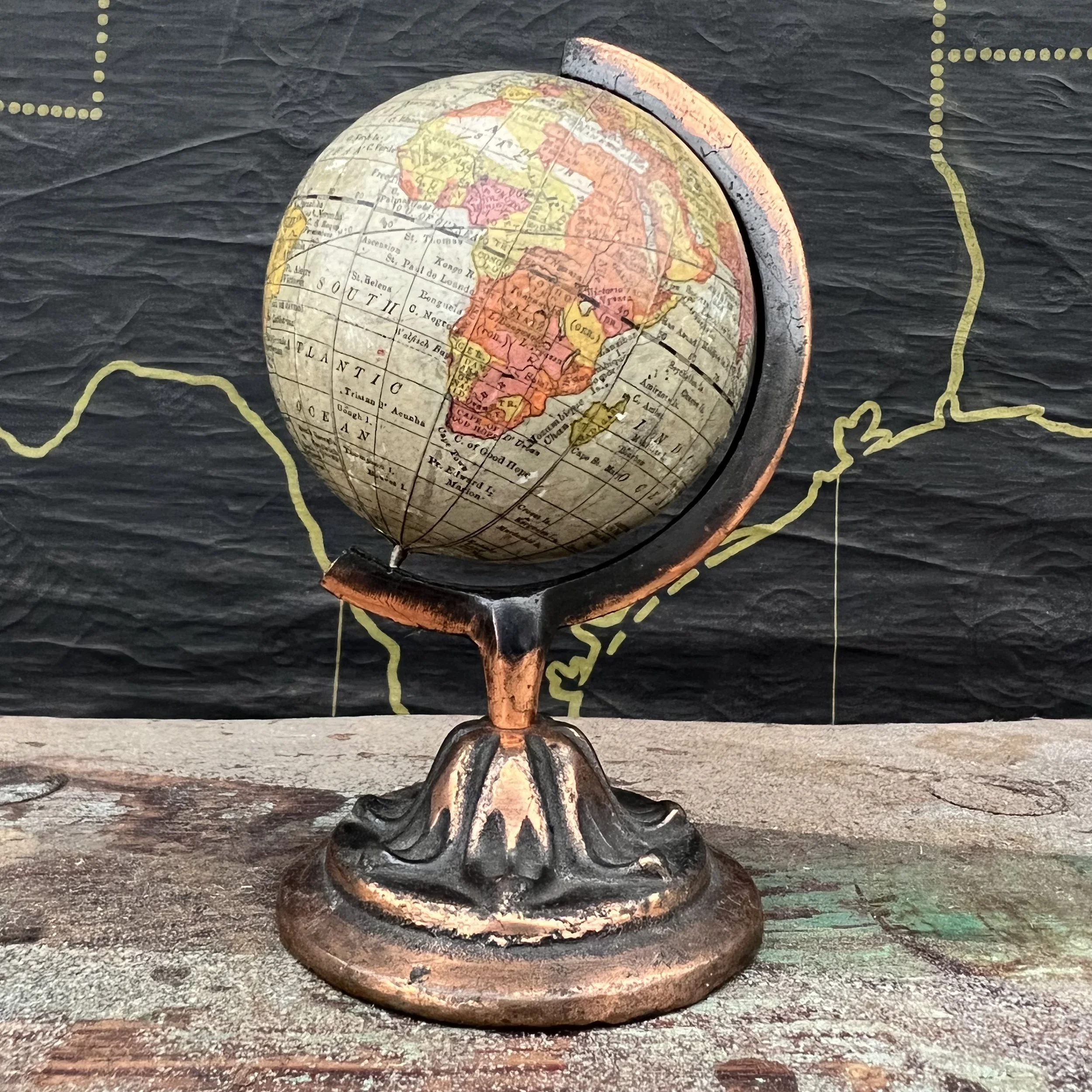
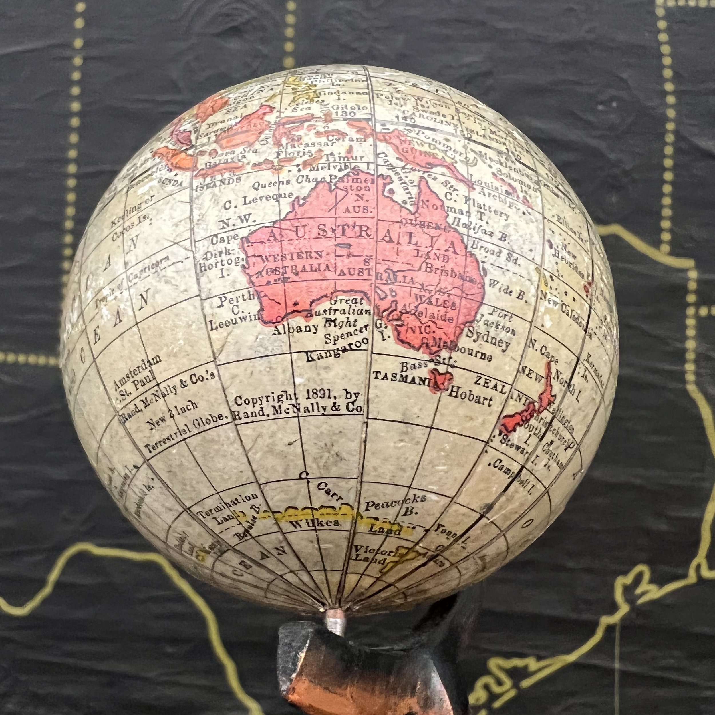
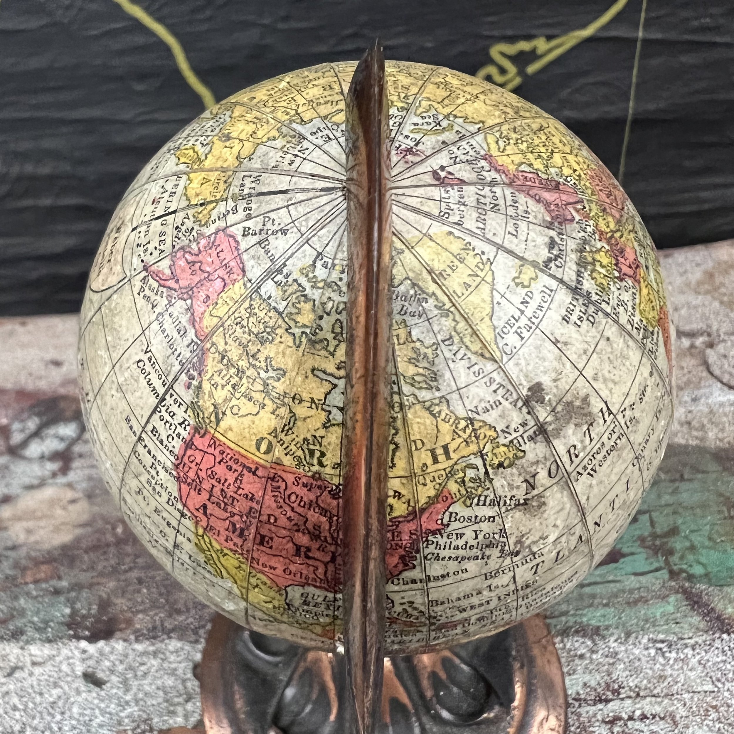
This petite Globe is a fine example of superb craftsmanship which elevated Rand McNally to be one of the great Chicago Globe makers of the late 1800’s and early 1900’s. This particular model is even dated 1891. Attention to detail is evident throughout the map in spite of being petite. The perfectly aged patina provides a warm glow and highlights superb map skills of the past.
History of the Globe Maker:
Rand McNally & Co. 1856 (1880 globe production) – current Chicago William Rand opens his first print shop in 1856, hires McNally, an Irish Immigrant, in 1858. In 1868, the two establish a partnership and the name Rand McNally & Co. As a print shop they produce the newspaper for the Chicago Tribune as well as timetables, travel guides and tickets for the fast growing railroad industry. In 1872, the company pioneered cerography, an innovative wax-engraving print technique, enabling to follow world changes in print quickly and more economically. As a result, event though not having made globes themselves until 1880, by the end of the late 1800’s Rand McNally produced globe gores not just for their own models, but for many of the other Chicago globemakers. Rand McNally is best known for their travel maps but also still produces globes to this day, mainly for the educational market.
Description:
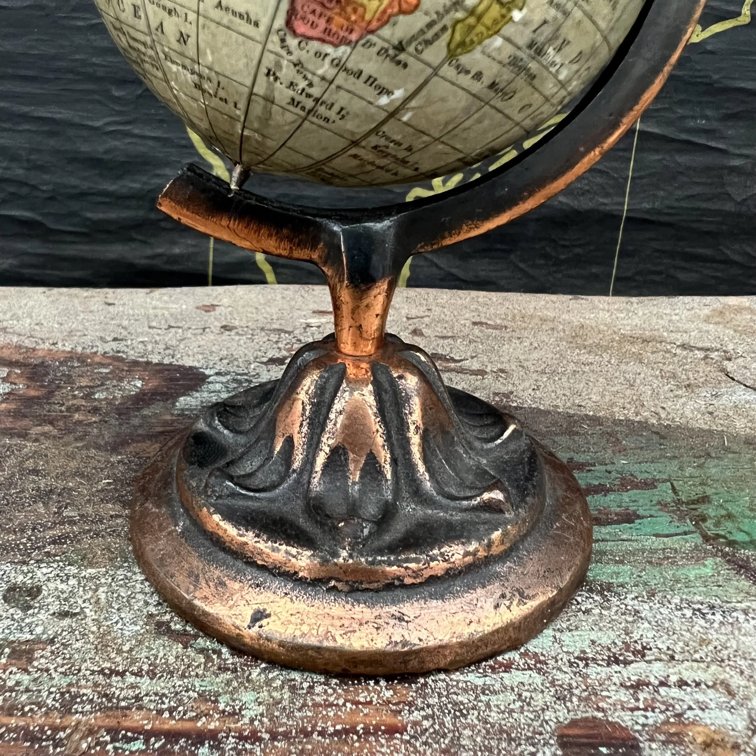
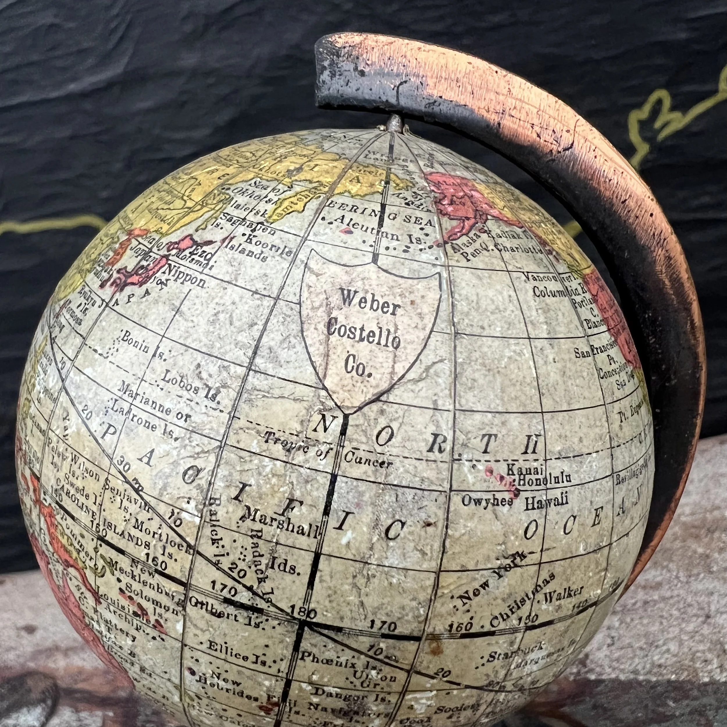
The orb itself is covered with 12 individual, hand mounted paper gores. The map has beautiful coloring with a wonderfully aged patina. The petite globe is mounted into a cast metal non-numeric half meridian with a copper finish. Diameter of the globe itself is 3 inches with a total height of 5.75 inches.
Condition:
This globe has been well maintained and is in good shape! Colors are rich, details crisp. Soiling is minimal. The mount shows some wear consistent with age. Please see pictures for detail.
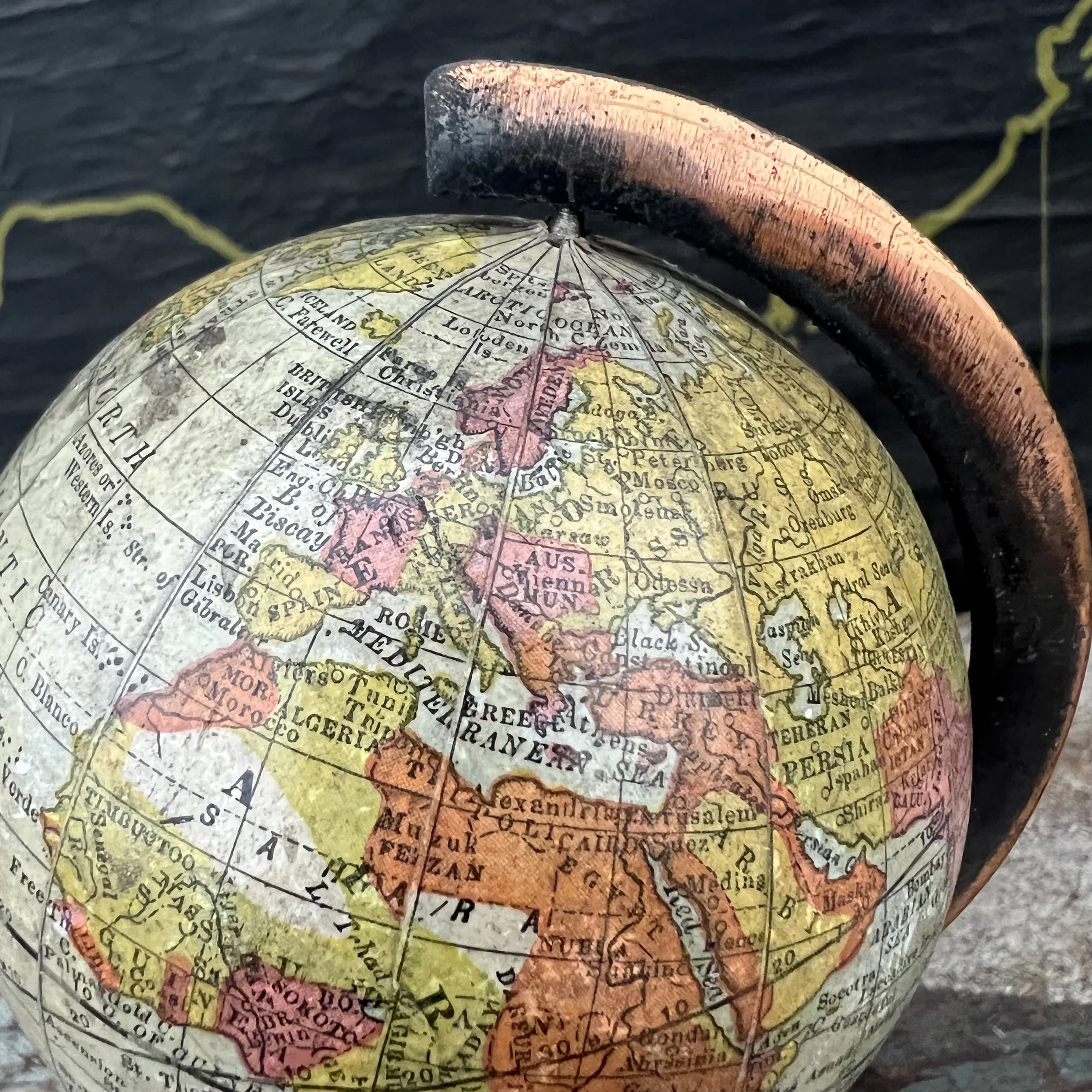
The age of the Globe has been dated 1891 and displays the following political borders: Europe: The Austro Hungarian, Ottoman, Russian and German Empire are identified as well as the Metropolitan cities of Christiana, Constantinople, St Petersburg and more. Middle East-Asia: The extent of the Ottoman Empire is evident. The Arabian Peninsula is identified as such, no Saudi Arabia, Iran, or Iraq. Africa: German Colonies are shown (lost at the treaty of Versailles post WW1), Kongo Free State is identified (became Belgian Congo in 1908). Egypt has yet to establish its borders and what is later Libya is identified as Tripoli instead. Orange Free State is visible. Rhodesia has not yet replaced Ndebele territory of Zimbabwe.
SKU- 1122RMCNBR91